

Image – N Devon Gazette (FATC)
“If Waterloo was won on the playing fields of Eton, surely the sands of the North Devon beaches contributed importantly to the success of the assault over the Normandy beaches.” (Paul W Thompson, Brigadier General, US Army)
With the 80th Anniversary of the D Day Landings coming up on June 6th this year, it is a good time to examine the role north Devon played in preparations for this significant event. This series of six blog entries looks in detail at the activities that took place on the north Devon beaches, and offers some suggestions for walks that allow exploration of the locations in person.
PART ONE: Overview of a walk through the training area & summary of key events
PART TWO: History of the Assault Training Centre
PART THREE: Detailed look at events that took place at the north Devon beaches
PART FOUR: Walk at Crow Point
PART FIVE: Walk at Braunton Burrows
PART SIX: Walk from Croyde to Putsborough

Crow Point. Image – Google Earth
The Geography of Crow Point and Its Role in the Assault Training Centre
Crow Point is a natural sand spit that lies in the Taw and Torridge Estuary. In ‘Tarka the Otter’, Henry Williamson refers to Crow Point as ‘Crow Island’. Although today Crow is connected to the mainland, in the 1920s it certainly was separated as an island. Geographers speculate whether it might revert to this state again – it probably has been an island intermittently for centuries.
It is found at the southern end of Braunton Burrows which is at the centre of the North Devon Biosphere Reserve and the North Devon National Landscape (formerly known as an AONB).

Image – Paul Berry
The area around Crow Point was designated as ‘Area A’ in the Assault Training Centre (ATC), set up to prepare American troops for the D Day landings. This sheltered part of the estuary was predominately used to rehearse launching troops and vehicles from ships and amphibious vessels (landing craft) that came across the river from Instow. Inland sections of the area were used for specialist training and practising and trialling weaponry.
Area ‘A’ was divided into coded beaches:
Estuary Blue I and II
Estuary Red II
Estuary Green II
Estuary Yellow II
‘Estuary Blue I’ ran along the seaward side of Crow Neck to Crow Point. This area has since been strongly eroded by the sea.
‘Estuary Blue II’ stretched along the north shore of Broadsands from the White House almost to the beach access road from Broadsands car park.
‘Estuary Red II’ was the area of the south-eastern face of Crow Point. It provided an alternative embarkation point to ‘Green II’.
‘Estuary Green II’ corresponded to the eastern side of Crow Point, and was used for the embarkation of vehicles.
‘Estuary Yellow II’ continued anti-clockwise from the boundary of Blue II beach around the inside of Crow Neck to Crow Point. It was covered up to low water with replicas of beach obstacles that would be encountered in Normandy.
A Walk Around the Crow Point Area

Crow Point Walk PDF – Crow Point Walk PDF
Total distance: 3.75 miles (6 km)
Terrain: Flat, but some areas of loose sand
1. The walk begins at Crow Beach House, known as the ‘White House’ for obvious reasons. Please note that access here by car can only be gained via a toll road with charge of £2.50 throughout the year. The White House is a prominent landmark that can even be identified from the far side of the estuary. It was earlier the Ferry House, the slipway alongside being the site of the old ferry to Appledore which fell into disuse in the 19th century. Nearby was the site of St. Anne’s Chapel, now lost in the dunes. In 1843, the Marsh Inspectors gained ownership of the White House, and in 1942 it was requisitioned by the war department and used for storage of ammunition and land mines which were placed on the beach from the estuary to Saunton.
2. Follow the road / path to the main car park at Broadsands.
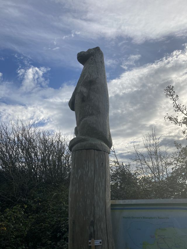
Broadsands car park totem pole. Image – Paul Berry
3. Pick up the path at the far end of the car park, where you will pass a carved ‘Tarka’ totem pole. Follow it until you reach a junction with the American Road (built by the GIs who trained here).
Broadsands car park totem pole. Image – Paul Berry
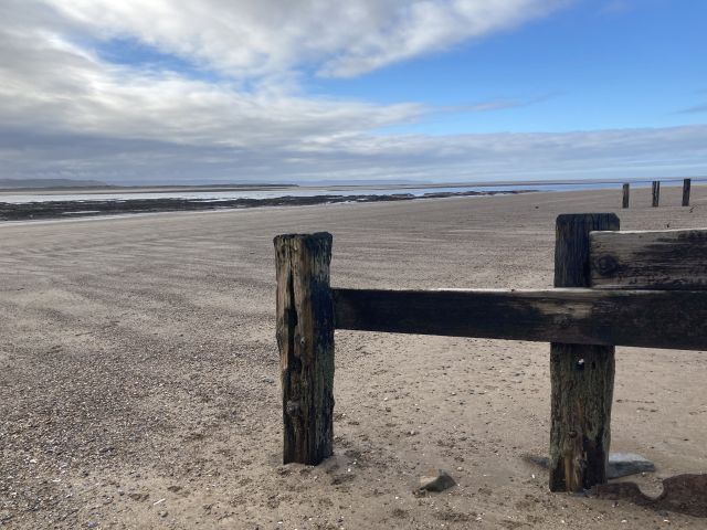
4. Turn left here to reach the access to Broadbands beach, marked by a number of boulders that prevent vehicular access. This was an important location for landing craft training – embarkation, loading and debarkation. At the top of beach can be found the remains of a lateral concrete wall and individual beach obstacles, all with explosion damage.

Landing Craft Practise, 1943. Image – Tony Koorlander
5. Pause for a while on the beach to enjoy the view of the Taw-Torridge estuary. The river Taw flows from the left, with Barnstaple in the distance. Directly opposite (across the river Torridge) you can pick out the villages of Instow, the old Yelland power station jetty, and the Zeta Berth jetty used for amphibious vehicle training. On the near side of the river to the right is the sand spit of Crow Point, and behind it on the far bank is the village of Appledore.
6. At low tide, you can turn right towards Crow Point to get a better view of the confluence point of the rivers Taw and Torridge. At the end of the spit is a small tubular steel lighthouse, only 5 metres high. Its light flashes every 2.5 seconds and can be seen from a distance of six nautical miles. It was originally powered by acetylene gas, but was converted to solar power in 1987.

New lighthouse at Crow Point. Image – Paul Berry

Wrecked boat, Crow Point. Image – Paul Berry
7. Keep heading to the right along the coastline, and you will reach the ruins of an old lighthouse and some timber groynes. The original structure was built here in 1820, and stood at a height of 86’. It played a crucial role in guiding ships through the dangerous Bideford Bar sandbank in the estuary. The old lighthouse was crewed by a two-man team, and its light could be seen for 14 miles out to sea. It was demolished in 1957 and replace by the unmanned structure you have just passed. Along with the original lighthouse, a life boat station was built here to aid sailors in trouble in the Bristol Channel that surrounds the area. It was demolished too, but some evidence of the original structure still remains.

Old Lighthouse Crow Point. Image – North Devon Athenaeum

Crow Point. Image – Paul Berry
Crow Point. Image – Paul Berry
8. Continue along the coast towards Airy Point, where the coastline bends northwards. If you are feeling energetic, you could keep walking all the way to Saunton – but it is a slog along the sand for some four miles. Alternatively, after ten minutes or so, take a steep path that rises into the dunes.
9. Enter the dune system of Braunton Burrows through gate 17, and head for the hillock straight ahead.
10. The path runs alongside to the left, and becomes more clearly defined. Continue to the dune ridge ahead (which you could climb for excellent views of the estuary and parts of the ATC) and pick up the obvious track that leads out of Twayblade Slack at the top.
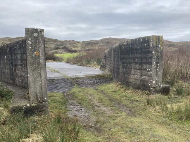
11. Continue along this track, and turn right at the crossroads at the bottom to reach the concrete mock ups that represented some of the landing craft used in the assault training. (What3Words: cheerful.sharpened.graph). A series of scale outlines of Landing Craft Vehicle Personnel (LCVPs) and Landing Craft Mechanised (LCMs) were created, and troops practiced on these before moving to assembly areas for actual embarkation on landing craft on Broadsands beach. To the north of the LCVP and LCM mock up area, six Landing Craft tank (LCT) and two LCMs were constructed. These were much larger and substantial structures with concrete bases to represent LCTs with lowered ramps as if they had just been beached. 6-foot high scaffold poles stood around their edges with canvas curtains or corrugated iron used to recreate the sides of craft. The original bases were built to the dimensions of the Mark IV LCT, but as landing plans developed it became clear that the Mark V version would be used in the invasion. Additional aprons were added to the rear of the existing bases to represent the extended deck area of the updated craft. Inscribed in the concrete of one such extension is the mark of its constructors, “146 ECB, Co C, 1st Platoon”.
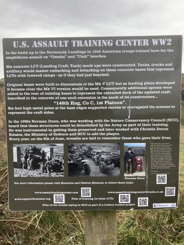
Image – Paul Berry
Concrete base of mock landing craft, Braunton Burrows. Image – Paul Berry
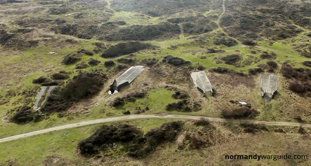
Image – normandywarguide.com

Image – Paul Berry
Image – Paul Berry

Assault section landing. Image – warhistory.com
See the landing craft in action:
12. After leaving the landing craft mock ups, continue on the track to exit onto the American Road via gate 21 (What3Words: unhappy.locals.scornful).
13. Turn right to where it broadens out into an open space. There are often soldiers gathered here while taking part in present-day training exercises.
14. Pick up the path to lead you back to the Broadbands car park, and the White House beyond.
Hope you enjoyed the walk!
